Friday, October 12, 2007

Water quality in Ireland 2006 - ups and downs

The Environmental Protection Agency has launched its 66 page 'Water quality in Ireland 2006 - Key Indicators of the Aquatic Environment' report.

Having monitored Ireland's surface and ground waters between 2004 and 2006, it shows "an improvement in river and lake water quality, but poorer quality in some groundwaters". Findings included that:
  • River channel: 71% was of satisfactory water quality.
  • Lake surface: 92% was of satisfactory water quality.
  • Estuarine/coastal water bodies: 19% were eutrophic; 3% were potentially eutrophic.
  • Groundwater samples: 57% contaminated by faecal coliforms; 25% exceeded the national guideline value for nitrate concentration for drinking water, and 2% breached the mandatory limit.
  • Fish kills: fewer than in 2005, but still unreasonably high.
For more:

Wednesday, October 10, 2007

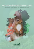
Red squirrels pushed west as greys dominate the east


The latest survey of Irish squirrels, published October 2007, shows that grey squirrels now dominate the east of the country, with the threatened red squirrels pushed to the west, south-west and north-west regions.

Grey squirrels were introduced to Ireland in 1911 and are rapidly colonising the country. They damage broadleaf trees, outcompete red-squirrels for food, and are carriers of a squirrel pox virus that does more damage to red squirrel populations than to greys.

Kerry launches its biodiversity action plan

Co Kerry has launched a 4-year heritage and biodiversity plan. One of the objectives is to identify important unprotected or at-risk habitats, landscapes and archaeological sites.

Habitat of importance to Kerry’s biodiversity includes woodlands, aquatic ecosystems and rapidly declining hedgerows.

The Heritage Council has links to local county heritage plans.

Sunday, October 07, 2007

Machairs in Mayo - a rare dune ecosystem.

Northwest Ireland has several areas of rare machair dunes including those stretching from Mulranny salt marsh to Rosmurrevagh peninsula in Clew Bay, Co.Mayo.

Machairs are fertile, low-lying dune areas - a unique form of coastal grassland (described as 'raised beaches' by Wikipedia). They are formed when sand catches in coastal vegetation, such as marram grass. Consequently, the plants gradually move upward, more sand is caught, and the land's surface is raised.

Although little research has been done into machairs, they are known to support a rich variety of species including many birds and insects (such as the belted beauty moth). Machairs also provide habitat for up to 150 species of flower, some of which are endangered and protected, including the Irish Lady's Tresses.

Machairs are vulnerable to erosion and rising sea levels. In 2007, Mulranny village received the inaugural Notice Nature Biodiversity Award, part of Ireland's Tidy Towns competition. The award recognises over a decade of conservation work to protect and restore local machairs. The Mulranny Causeway loop walk provides access to part of the machairs.

Saturday, October 06, 2007

Ireland Flora & Fauna

Ask About Ireland's illustrated Introduction to the Flora and Fauna of Ireland, by Michael Viney is an enjoyable, informative read. Topics covered include:

  • Howth Peninsula
  • The Birds of Ireland
  • Selected Wild Flowers of DĂșn Laoghaire-Rathdown
  • The Flaming Wheel nature essays about the countryside of Wicklow and Dublin
  • The Tobacco Growing Industry in Meath
  • The Wildflowers of Bull Island: The Grassland Dunes
  • Wild Plants of the Burren
  • Wild Wicklow
  • Wildlife of the Parks of South Dublin County
  • Trees of Woodstock Arboretum, Kilkenny
  • Flora and Fauna of Wexford Sloblands
  • Flora and Fauna of Wicklow
  • Flora of Wicklow
  • Habitats of Carlow

Interactive maps of Ireland's environment

The Environmental Protection Agency's ENVision tool enables you to access and map information on Ireland's environment and land use. It includes information on:

  • Air and water quality (including of rivers, lakes, estuaries, coastal and bathing waters);
  • Land cover information;
  • Soil and subsoil;
  • Locations of Water Framework Directive Protected Areas and River Basin Districts, hydrometric stations and river catchments;
  • Location of towns, rivers and lakes;
  • Facilities licensed by the EPA (e.g. facilities with waste licences).

Designation of Nature Conservation Sites in Ireland

The 22 page report 'Living with Nature, the Designation of Nature Conservation Sites in Ireland' outlines the different types of conservation site in Ireland, a guide to the designation process, consultation and planning issues, likely impact of designation on farming practices and land use and compensation for land owners and users.

It also includes examples of Irish conservation and special areas and a list of habitats listed in Annex 1 of the Habitats Directive for which sites have been selected in Ireland.

Maps of Protected Areas in Ireland

The Department of the Environment, Heritage and Local Government is responsible, through the National Parks and Wildife Service, for the designation of conservation sites in Ireland. There are three types of protected areas in Ireland:
  1. NHAs - Natural Heritage Areas
    A basic wildlife designation. Many NHAs overlap with SACs or SPAs. There are 802 that don't, covering 1,130 square kilopmeters.
  2. SACs - Special Areas of Conservation
    Prime wildlife conservation areas, of importance in Irish and/or European context. These are selected and designated under the EU Habitats Directive and transposed into Irish law in the European Union (Natural Habitats) Regulations, 1997. Ireland has 381 candidate Special Areas of Conservation, covering circa 10,000 square kilometres. Approximately 25 SACs are also designated SPAs. View map of Irelands Special Areas of Conservation.
  3. SPAs - Special Protection Areas
    Primarily areas of importance to birds. Designated under the EU Birds Directive. 110 SPAs have been designated, with a further 25 proposed. View map of Ireland's Special Protected Areas.

Find out more at:

Heath-bog habitat protection for endangered Hen Harrier

The blanket ban on planting forestry in certain areas important to the survival of the endangered hen harrier has been lifted (March 2007). Instead, the Government has established a new forestry management protocol for the forestry and farming groups who had objected to the ban.

Under the protocol, six Special Protection Areas (SPA), important to the hen harrier, have been designated. In these, limited sustainable and quota-based afforestation will be allowed . It is thought that this will facilitate the protection and enhancement of the hen harrier's preferred habitat, including heath and bog. The National Parks and Wildlife Service will monitor the protocol's impact on habitat.

The Special Protection Areas include the:

  • Slieve Bloom mountains (Laois and Offaly);
  • Stack's to Mullaghareirk mountains, West Limerick hills and Mount Eagle (Cork, Kerry and Limerick);
  • Mullaghanish to Musheramore (Cork);
  • Slieve Felim to Silvermines (Limerick and Tipperary);
  • Slieve Beagh (Monaghan) and
  • Slieve Aughty mountains (Clare and Galway).

Read more:

The island of ireland

Once upon a time, and for 15000 years, ice a mile high blanketed Ireland. When the lingering Ice Age finally released and the Irish ice departed it left a landscape scoured. Across land bridges linking Ireland, Britain and mainland Europe plants and animals arrived to colonise the new lowlands, mountains and valleys. The world’s ice continued to melt, the sea levels to rise, and some 8000 years ago Ireland became the island we now know, accounting for just 0.01% of the world's total land area and the most westerly point of Europe.

Though at Alaskan latitudes, the country's climate is tempered, due partly to the neighbouring waters of the Gulf Stream and partly the prevailing southwesterlies that veering and backing make landfall on our sodden coast. These offerings from the Atlantic mean it is never too hot, never too cold. But without doubt it is wet. Rain lingers year round, never far away, though is most frequent in winter, the western counties and, inevitably, on the day of your parade.